On the marshy swampland plain by the west edge of Črna Vas stands a parish church of St. Michael. The building, with a double-peaked roof, is characterised as an unusual sacral bell tower reminiscent of a karstic horsetail. The architect Jože Plečnik designed the church with the staircase with a floor plan in the shape of the letter T for his nephew, the priest Karl Matkovič in 1937. It was constructed in 1939. The exterior of the bell tower is built of stone and brick; parts of façades are laden with stone and wood. In front of the bell tower and the church is a wide concrete staircase, which leads through the triumphant arch opening to the sanctuary on the first floor. On the ground floor under the church are the living quarters for the priest.
Photo taken from about 8 metres.
The church is one of the most imaginative works of Plečnik's architecture. The complex design reminds us of the northern wooden buildings and influences of the Far East. It is also reminiscent of the central floor plan concept of the university library as well, where visitors ascend the colonnade towards the light of knowledge, while in the Church of St. Michael it is towards the light of God. The entire structure has a very balanced and homey appearance.
For higher-res photos visit my photo stream. You can also find my on all major social media.
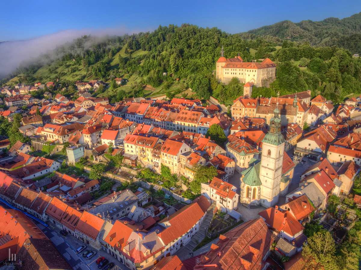
The name Škofja Loka derives from the medieval times and it was originally named Loka, which means wet, grassy area near water. However, at that time there were many Lokas in Slovenia, and there had already existed a rural settlement named Loka (today’s Stara Loka) not very far from the town, therefore later on Škofja was added to the name Loka. This adjective is linked with the donation of the Loka region to the Bishops of Freising, and the town of Loka was thus renamed to Škofja Loka.
Old centre of the town with castle in the background.
There is a Negro with a crown in all symbols of Loka, which relates to the legend about the land lord Abraham and his servant. The legend says that they were travelling along the Poljanska dolina valley and they met a big bear in dark woods. Bishop Abraham stopped, but the Negro drew a bow and shot the bear. Abraham had the head of the Negro pictured in the town coat-of-arms in order to thank the servant for having saved his life.
River Sora runs through Škofja Loka.
You can read more on the topic here. More HD photos of Škofja Loka and more you can find in my photo stream or on social networks.
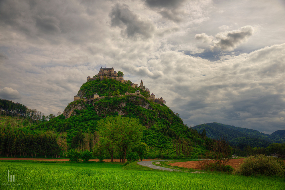
The Castle Hochosterwitz was built on a limestone rock that rises 150m above the valley and allows the visitor a spectacular view over the neighbouring mountains, hills and countryside.
The castle was first mentioned in 860. It was a refuge for the local population during the Turkish invasion in the 11th and 12th century. After the death of Hans Schenk von Osterwitz, the last owner of the original lien, the castle was returned to King Friedrich III.
Aerial photo of Castle Hochosterwitz.
In gratitude for the support of the imperial troops during the wars against the Turks the lien of thecastle Hochosterwitz was given to Christoph Khevenhüller von Aichelberg by Kaiser Ferdinand I in 1541. Christoph Khevenhüller started to rebuild the castle according to the plans of one of the greatest military architects of that time: Domenico dell’Aglio.
Georg Khevenhüller extended the buildings to their actual size using his own private money. In the castle yard a marble memorial tablet dated 1576 proclaims that Georg Khevenhüller had „reconstructed this castle with his personal means. It being his home, he surrounded it with walls and fitted out with bastions and an arsenal“.
Church on the hill just outside the fortress walls. Taken in infrared.
Since then the Castle Hochosterwitz has been owned by the same family for generations.
Many centuries have passed, but castle Hochosterwitz has not changed – only its purpose became a different one. Luckily, there was always some member of the family who, remembering the warning carved in stone by his ancestor, made great sacrifices to maintain the castle in good condition.
Slovenian name of the castle is Ostrovica.
For more information please visit castles' webpage.
More photos of the castle and its surroundings you can find in my photo stream or on social networks.
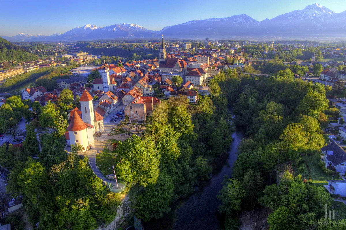
The old town of Kranj, historically also named Carnium, Creina, Chreina, or Krainburg, is a historical town situated on a conglomerate prominence between the rivers Sava and Kokra. The city area was inhabited as early as the Celtic period in the first millennium B.C. The town achieved one of its peaks in the 7th century, the era of people’s migration and arrival of Slovene settlers. During that time, an important strategic fort and, consequently, Kranj’s first settlement was founded. The biggest and oldest Slovene burial ground bears witness to this fact.
Aerial photo of old town centre.
Kranj lost its independence at the turn of the 9th/10th centuries, when it became the seat of the March of Carniola. Later on, the March of Carniola became the Carniola Dukedom, with its seat moving to Ljubljana. The development of trade in the 13th century provided Kranj with its city rights and a number of city privileges and benefits for further development of trade and transport of agricultural products as well as development of ironwork. In the first half of the 19th century, Kranj was a market trading town. At the end of the 19th century, manufacturing was established and thrived to the extent that Kranj became more industrial in nature.
Kranj with Alps in the background
The medieval layout of the Kranj town centre is in the typical pyramidal form with an emphasis on church steeples. Another feature is the north-south axis, indicated by the visual link between the Kranj Parish Church and the Storžič summit. Undoubtedly, the planned placement of a number of high dominating features in the city area ranks Kranj among the most carefully considered urban developments in not only Slovenia but also Central Europe.
Kranj is situated between the rivers Sava and Kokra
At the end of the Middle Ages and the beginning of the Modern Times, the town was guarded by a city defence wall with towers, the castle and the Škrlovec armoury from the west side of the Sava. The floor plan composed a narrow space between both rivers with two access roads, one at the former Main Town gate located on the current Maistrov trg and the other one at the Lower Town gate in today’s Vodopivčeva uclica. The old town centre comprises the Main Square (Glavni trg) and Prešerenova ulica, which are linked with two parallel streets. The arcade passageways were built in Tomšičeva and Tavčarjeva ulica, which used to connect the backyards of the bourgeois houses with the town square. The town boasts bourgeois houses, wonderfully shaped streets, mansions, churches and houses with architectural ornately decorated façades and courtyards.
The fairytale landscape offering views toward the sea, the Friuli and the Veneto, has a special, magical power. Brda, the land of hills, nested midway between the Alps and the Adriatic, preserves and develops its heritage, safeguards its beauties and generously bestows its delights on anyone who visits the area.
Blossoming Cherry trees among the vineyards.
Although the times of fairytales are over, fabulous images of Brda are becoming increasingly real. The abundance of beauties, curiosities and adventures always attracts attention of travelers who wish to get acquainted with Brda. Bearing the stamp of the past, today’s life in the villages and hamlets of Brda has been taking its own pace - tranquil and cheerful, surrounded by family and in harmony with visitors.
First sun rays caress Brda vinyards.
Although the Brda area is mostly cultivated and transformed into vineyards and orchards, it is also exceptionally interesting for nature lovers. Attentive traveler’s eye will notice numerous beauties, while those with more exploring spirit will ask around and the locals will reveal them a lot of interesting local geological, climatic and botanical features.
Awakening vineyards.
You will find more photos from the magical trip in my photo steam. Of course, you are welcome to visit my facebook page as well.
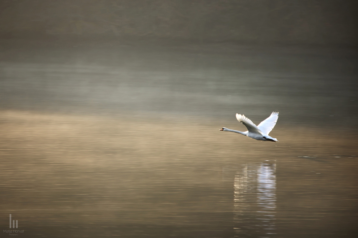
Did you too see it, drifting, all night, on the black river? Did you see it in the morning, rising into the silvery air - An armful of white blossoms, A perfect commotion of silk and linen as it leaned into the bondage of its wings; a snowbank, a bank of lilies, Biting the air with its black beak? Did you hear it, fluting and whistling A shrill dark music – like the rain pelting the trees – like a waterfall Knifing down the black ledges? And did you see it, finally, just under the clouds - A white cross Streaming across the sky, its feet Like black leaves, its wings Like the stretching light of the river? And did you feel it, in your heart, how it pertained to everything? And have you too finally figured out what beauty is for? And have you changed your life?
Finally I can show some aerial photos shot with my new DJI Phantom 3 (named Valkyrie :)). This batch was shot today. It was a cold morning but I still managed 23 minutes long flight. You can expect more aerial photos as this little Panasonic camera produces stunning photos for its size. I hope you like it.
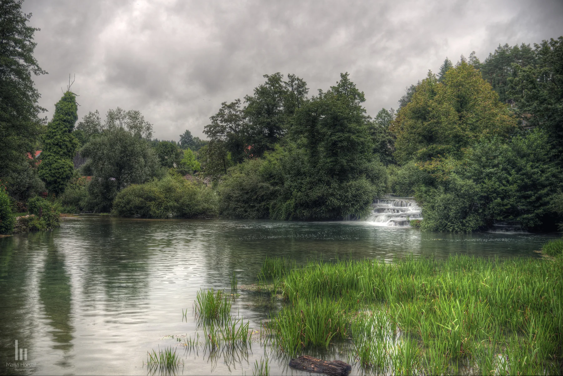
The Mrežnica is a beautiful river in Croatia which is well known for its cascades and travertines. About 100 cascades can be found along its course of 64 kilometres. Foamy cascade barriers and travertines alternate with green lake-like parts. Decelerated by these barriers, the river is an excellent biotope for frogs, water snake and other animals. The Mrežnica is appreciated as a place to swim or for rafting tours in the beautiful scenery of untouched nature.
Recreationists can admire water mills, whose primary function of grinding wheat or sewing wood has disappeared; their wheels do not produce flour, but they are exceptionally valuable as cultural heritage.
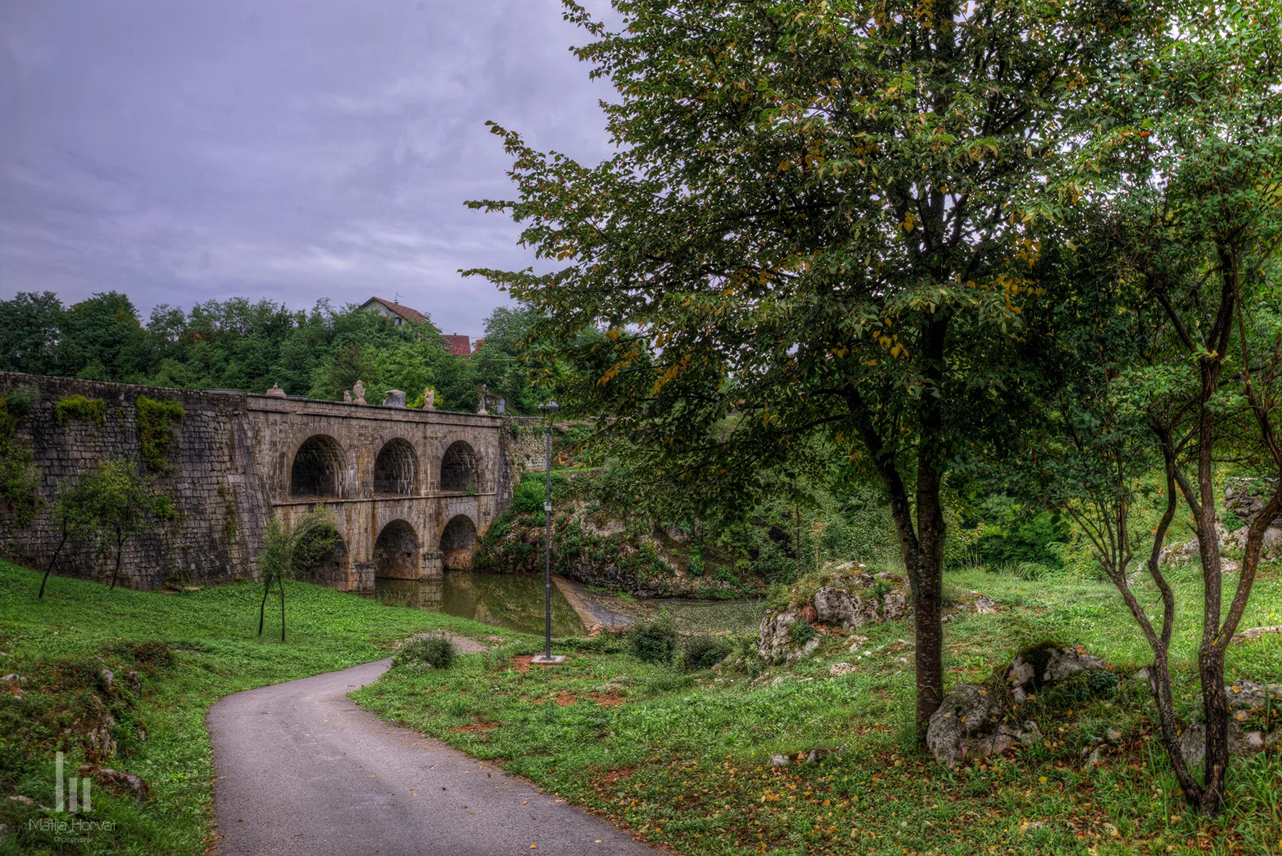
Tounj Bridge in the village of Tounj near Ogulin was built in stone. The bridge has two levels with three openings, crossing the Tounjčica River. The lower level was built in 1775, and the second level was added in 1836. This is the only bridge of this type in Croatia and this part of Europe. A pedestal in front of the bridge holds a statue of a Roman Soldier erected in 1775.
Rastoke is nicknamed ‘Small Plitvice’ as it shares some of the very features that make the Plitvice Lakes, situated close by, so popular. Like the Lakes, Rastoke too sits on a limestone barrier, and is blessed with a dramatically beautiful setting. This little village has grown along the edge of a respectable and robust waterfall where the Korana and Slunjcica rivers meet. These waters flow around and into the village, creating numerous streams and pools.
The serenity of the village masks a difficult, violent past. This region was one of the hardest hit during the war in the early 1990s. The entire village was horribly damaged. Homes were burnt down and the surrounding area was loaded with landmines and explosives. Since then, the region has undergone a successful restoration program carried out by the government. It has been de-mined and restored, maintaining the village’s architectural integrity.